


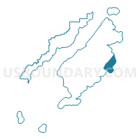
Chiniak Precinct, Kodiak Island Borough, Alaska
About
Outline

Summary
| Unique Area Identifier | 523419 |
| Name | Chiniak Precinct |
| County | Kodiak Island Borough |
| State | Alaska |
| Area (square miles) | 360.96 |
| Land Area (square miles) | 129.17 |
| Water Area (square miles) | 231.78 |
| % of Land Area | 35.79 |
| % of Water Area | 64.21 |
| Latitude of the Internal Point | 57.48847450 |
| Longtitude of the Internal Point | -152.37994010 |
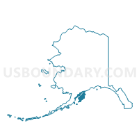
Maps

Graphs
Select a template below for downloading or customizing gragh for Chiniak Precinct, Kodiak Island Borough, Alaska


Neighbors
Neighoring Voting District (by Name) Neighboring Voting District on the Map
- Flats Precinct, Kodiak Island Borough, AK
- Kodiak Island South Precinct, Kodiak Island Borough, AK
- Mission Road Precinct, Kodiak Island Borough, AK